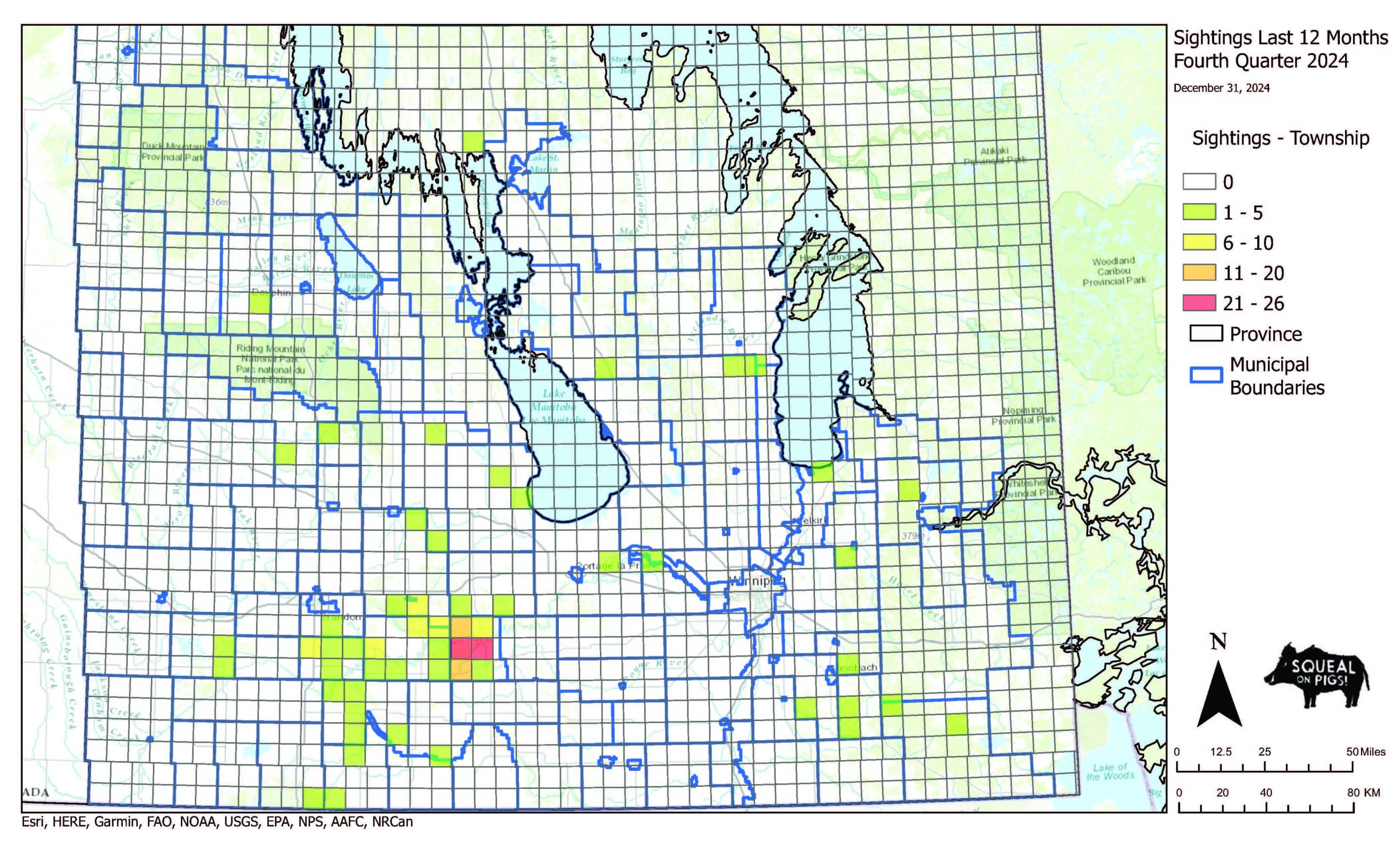
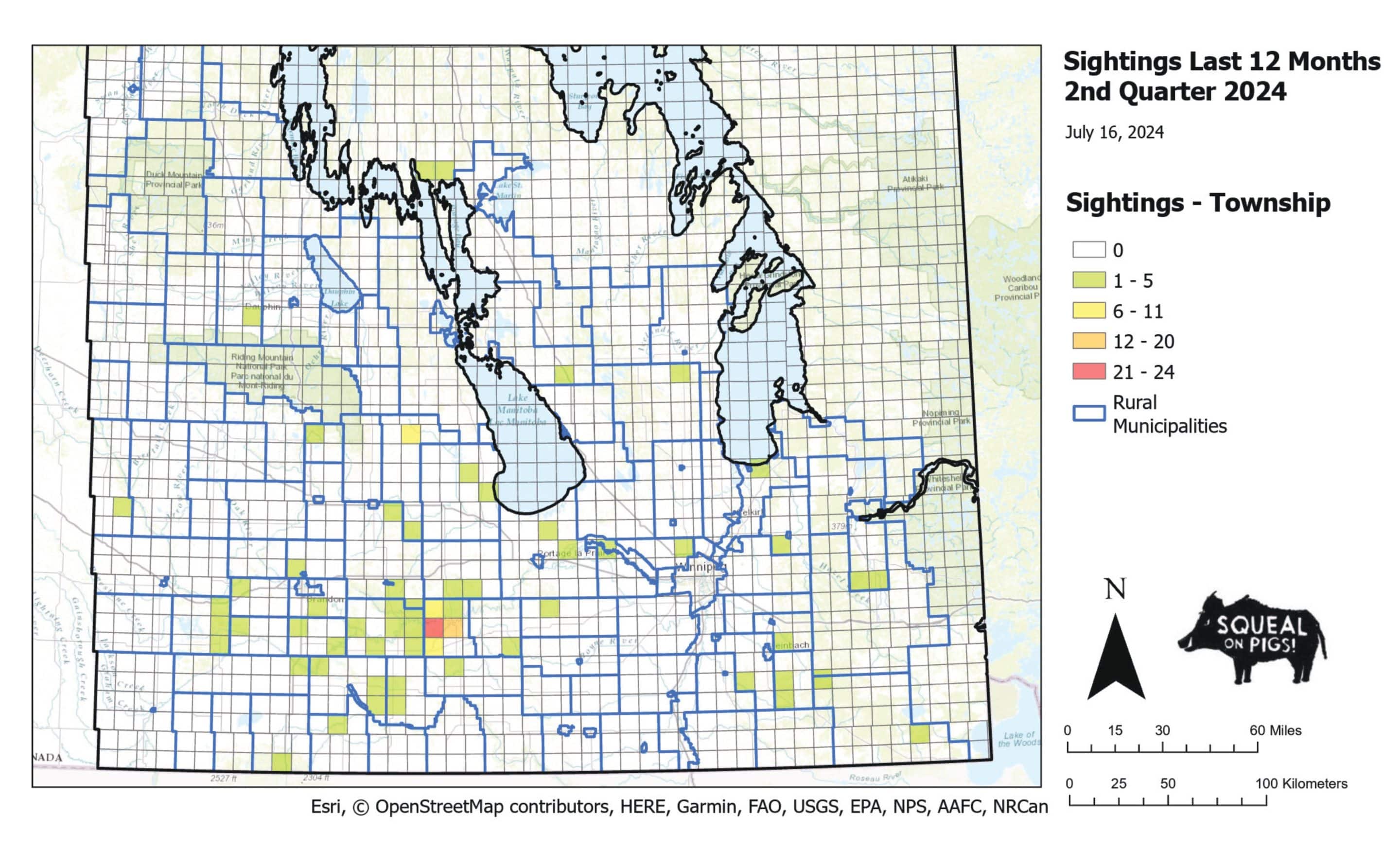
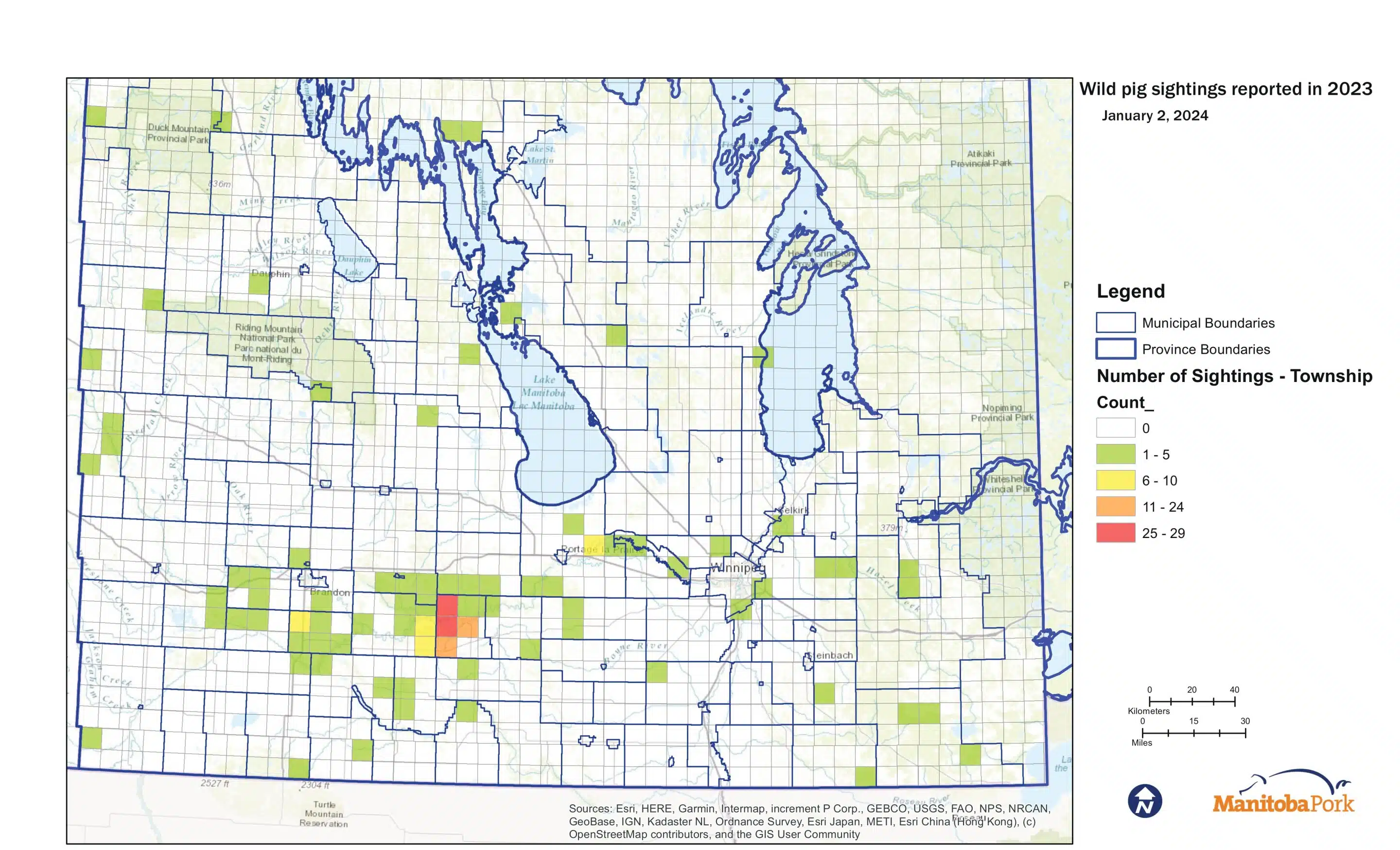
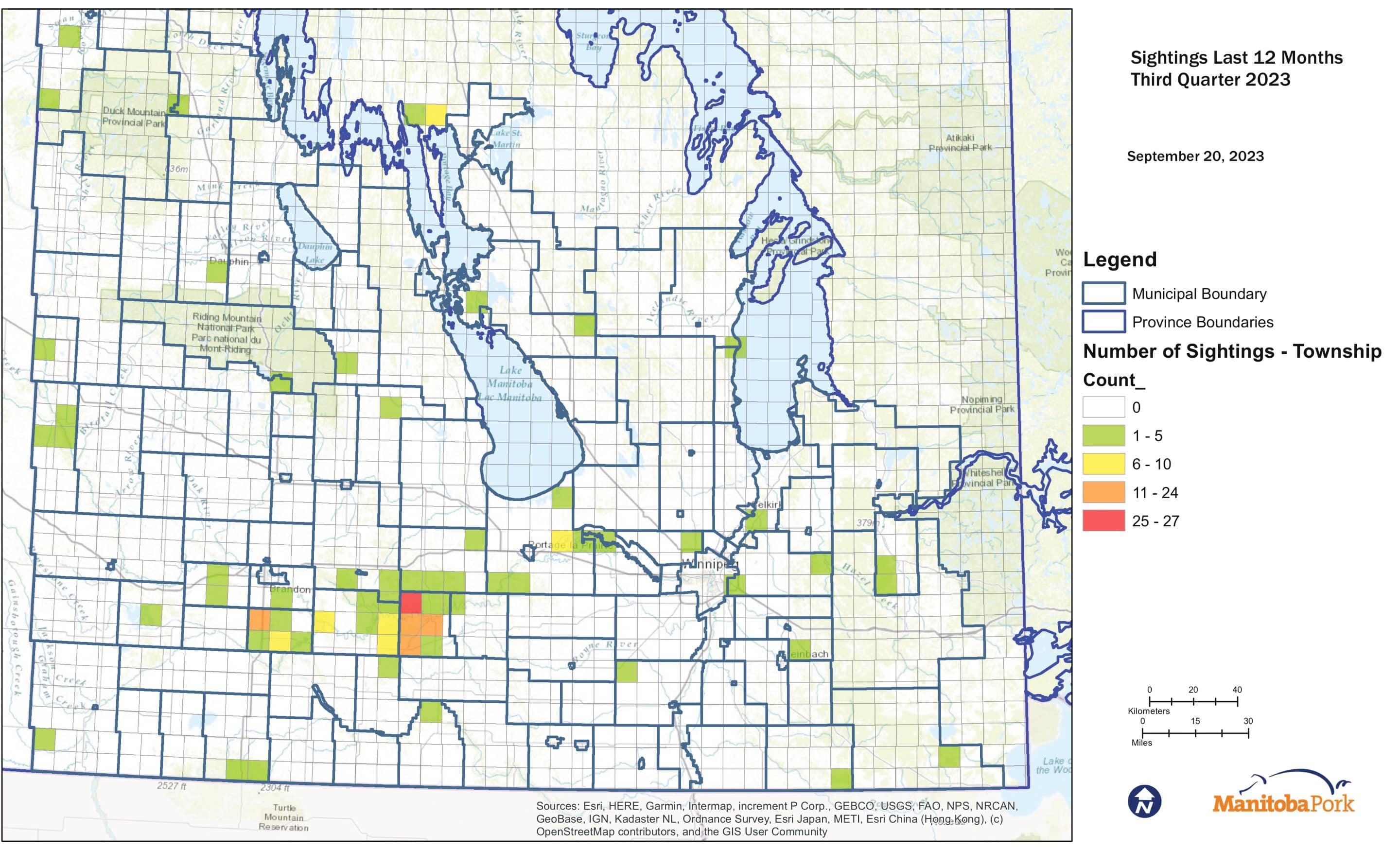
Mapping

Latest Map Release
March 31, 2026

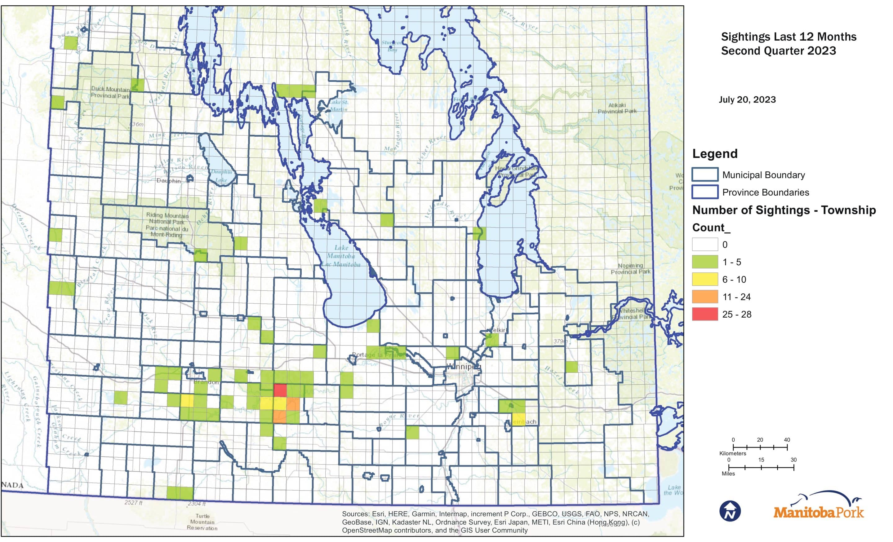
Note: Map interpretation – sightings indicate a location at which the presence of wild pig(s) has been confirmed, either through active surveillance (trail cameras/drone flights) or through reports made by the public. The number of sightings within a township is not a representation of the actual population of wild pigs, but indicates the number of locations at which a confirmed sighting has occurred. An elevated number of sighting locations is therefore not directly correlated with population; areas with active surveillance and removal activities will report a greater number of sightings due to these efforts.